OHIO —A storm system developing southeast of the region will allow for some moisture in the upper levels of the atmosphere to feed into our area, helping to produce some light snow to the eastern half of the Buckeye State.
In addition, a favorable lake-effect snow setup will start to emerge this afternoon thanks to a north-north-westerly flow across Lakes Huron and Erie. This should allow for lake effect snow bands to push into northeast Ohio with a couple inches of snow just east of the Cleveland metro.
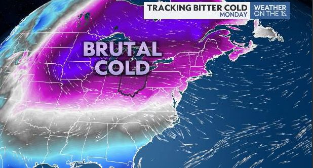
The main story though as we wrap up the weekend and start the new week continues to be the extreme Arctic airmass that is settling into much of the lower 48, bringing widespread arctic temperatures that the area hasn’t experienced in nearly six years.
In advance of this event, the entire state has been placed under a Cold Weather Advisory. We need to continue to prepare around the house and limit time outdoors over the next few days as our entire state will be impacted.
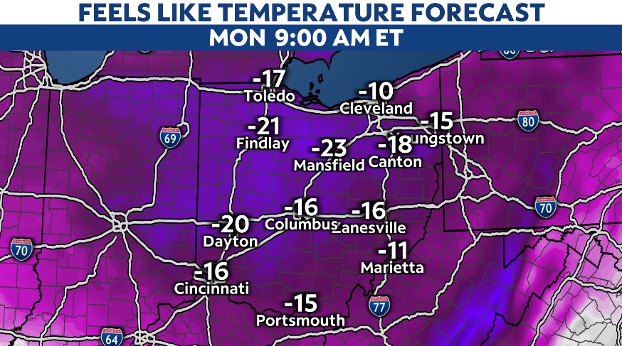
Arctic air will begin to spill in tonight, and wind chills tomorrow morning will be -15 to -20 degrees below zero.

Many spots in Ohio will not get out of the single digits for maximum temperatures both tomorrow and Tuesday, with wind chills expected to remain below zero both days.
Many schools and businesses will be closed tomorrow for Martin Luther King Jr. Day, but we may see school delays and closures on Tuesday.
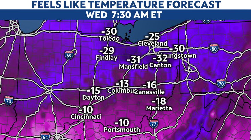
Wind chills are forecasted to be the coldest by Wednesday morning with some spots plummeting to -25 degrees to -35 degrees.

When we see this type of cold longer than 48 hours, it significantly increases the threat to our health and infrastructure. We strongly advise that you prep your home and car for burst pipes and dead batteries. Be sure to have extra layers of clothing to protect your skin, and limit your time outside, check in on your loved ones, and protect your furry friends too by bringing them inside to keep warm!
The Arctic airmass will begin to ease up towards the second half of the upcoming week as the large upper trough filtering in the Arctic cold shifts east allowing an area of high pressure to build in over the southern Great Lakes. This high will then shift east into the Mid Atlantic and promote a return flow of warmer air, helping highs recover by Thursday. Mid to upper 20s can be expected for the northern half of the state, with upper 20s to low 30s expected for the southern half of the state.
With the return of warmer temperatures will also be a return of some light snow associated with the next storm system that will swing through the Great Lakes by Thursday and Friday. We will fine tune the timing and details on that as we get into the upcoming week.
This article was originally published by a spectrumnews1.com . Read the Original article here. .

